|
CLOSED |
ROAD |
Closed |
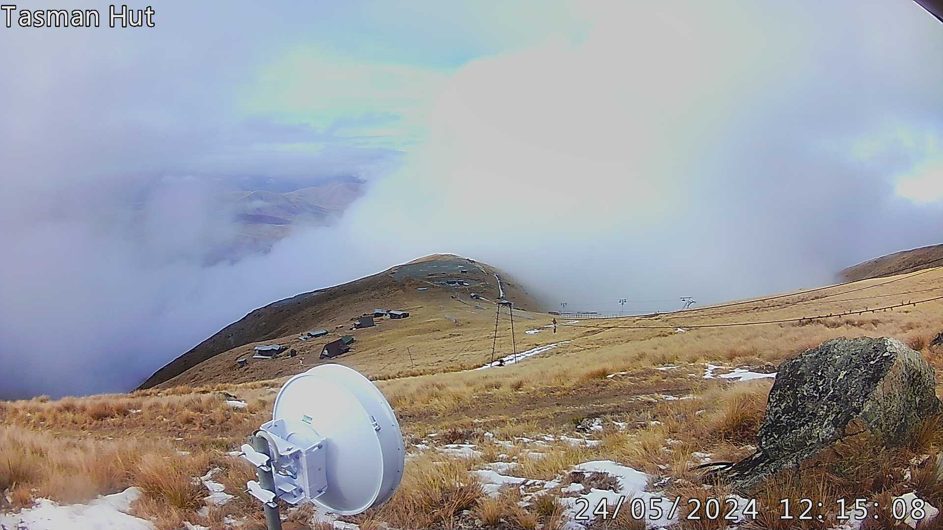
FOX LODGE |
Closed |
UPDATE |
10 Apr 2024 / 20:41 |
| On the countdown to the 2024 season, become a member of one of NZs best Ski Clubs. FULL MOON FEVER 2024 - AUGUST 17th book it into your calendar.
***2O24 TOURING or ONE UP PASS $40… we work hard to provide a touring Mecca at Fox for you all to enjoy 🦊 Check out - www.foxpeak.digitees.co.nz for all new unique T-shirt’s hoodies gifts etc. 🦊 support Fox Peak and buy online 😀 |
|
| Overcast Clouds |
|
|
|
-0.2°C |
|
|
Light Breeze 10.08 km/h NE |
© Opuha Water Ltd, data provided by ECS. More Info
Learners' Tow | | Closed |
Meadow Platter | | Closed |
Meadow Tow | | Closed |
Tasman Tow | | Closed |
Apex Tow | | Closed |
Learners' Area | | Closed |
Meadow | | Closed |
Shirt Front | | Closed |
South Slope | | Closed |
Happy Valley | | Closed |
North Slope | | Closed |
North Basin | | Closed |
South Basin | | Closed |
The Chute | | Closed |
Ski Touring | | Closed |
Peak Ascent | | Closed |
Issued 02 May 2024 01:42
| Today 02 May | Showers clearing this morning with fine breaks increasing. Wind at 1000 metres: Southerly gale 65 km/h north of the Rakaia Gorge, 40 km/h elsewhere. Becoming light throughout in the afternoon, then southwesterly 45 km/h developing south of the Rakaia Gorge in the evening. Wind at 2000 metres: Southerly 50 km/h, easing to southwesterly 30 km/h in the morning. Rising to gale 65 km/h south of the Rakaia Gorge in the evening. Free air freezing level: 1200 metres, lifting to 1900 metres in the afternoon. Active mountain weather hazards: Wind, Wind Chill. |
| Tomorrow 03 May | Fine. Wind at 1000 metres: Southerly 30 km/h dying out. Wind at 2000 metres: Southwest 50 km/h, easing to 30 km/h in the afternoon. Free air freezing level: 3000 metres about the Divide, sloping to 2400 metres elsewhere. Becoming 2800 metres everywhere in the evening. Active mountain weather hazards: Wind Chill. |
© Weather provided by MetService. More Info
See www.metservice.com for more detailed forecasts.
Fri | Sat | Sun | |
| 6 | 3 | 7 | 4 | 7 | 3 | |
| 5 km/h | 5 km/h | 8 km/h | |
| 2175m | 2700m | 2600m | |
| 0cm | 0cm | 0cm |
© Weather Unlocked. More Info
Forecast is updated 4 times per day.
If you're looking for a detailed weather report and the latest forecast,
your best bet is to check out MetService at www.metservice.com.
QUICK LINKSFULL SNOW REPORT SNOW CAMS TRAILS + MAP WEATHER FORECAST GETTING THERE BOOK ACCOMMODATION OFFICIAL MERCHANDISE |
GET THE UPDATESFor all the latest updates head to our facebook page |
|

|

|